

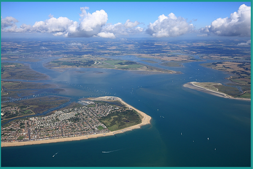
Solent Marine Sites
The Solent Marine Sites (SEMS) is one of a number of marine sites in the UK which are designated as internationally important sites for their habitats and species. SEMS covers the harbours, estuaries, areas of open coast and inshore water around the Solent. The site stretches from Hurst Spit in the west to Chichester Harbour in the east and includes areas along the north coast of the Isle of Wight from Yarmouth to Bembridge Harbour, as well as the mainland shores; SEMS is 781.1km2 in size.
The Solent and its inlets are unique in Britain and Europe for the complexity of the marine and estuarine habitats present within the area. Sediment habitats within the estuaries include extensive areas of intertidal mudflats, often supporting green algae, saltmarshes, eelgrass Zostera spp, and natural shoreline transitions, such as drift line vegetation. The rich intertidal mudflats, saltmarsh, shingle beaches and adjacent coastal habitats, including grazing marsh, support nationally and internationally important numbers of migratory and over-wintering waders and waterfowl as well as important breeding gull and tern populations.
Further information on the process of how activities are managed within SEMS are shown below.
- Annual Management Report
- Annual Meeting
- Annual Survey
- Management Scheme
- Management Scheme Activities
- SEMS Management Goup
- SEMS sites
- Strategic Stakeholders
- Site Condition and Advice
